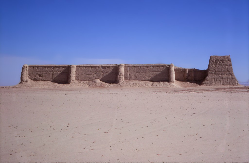


Qala-i Nau
Gazetteer ID: 871
Latitude: 30.93036067 Longitude: 62.13708568
Enlarged satellite view
This imposing fortress, also known as Chakansurak and Noken Qala, is at the northern edge of Sar-o-Tar outside the sand dune fields. It was extensively documented by previous researchers so warranted only a brief visit by HSP. While the well-preserved, decorated mudbrick walls are probably from Ghaznavid-Ghorid times, they sit atop an earlier fortress from the Partho-Sasanian periods, given the extensive ceramic scatter from that earlier time found inside the ruins and in the vicinity