


Sistan Region
The Sistan region has varied in name and dimensions over the millennia but largely refers to the closed area at the southwest corner of the larger Helmand River basin, west of the towering volcano Koh-i Khan Neshin to the hamun (lake) into which it drains, located on the border between Afghanistan and Iran. This 18,000 sq km landlocked depression is noted for its dry climate, extreme temperatures, and strong winds. From its narrow course 2-5 km wide near the mountains, the river widens into a delta-like basin and disperses its flow into several distributary channels and canals. Bordered by flat Dasht-i Margo and Dasht-i Jehannum deserts on the east, Dasht-i Lut desert on the west, and the sand-covered Registan to the southeast, it is one of the few habitable areas in southwest Afghanistan and southeast Iran because of its perennial flow of water.
Geological work by John Whitney and colleagues suggests the course of the Helmand River through Sistan was affected by tectonic factors, including a major fault that deflected the river northward, and by pronounced subsidence of the basin as well as surface factors such as the annual flooding in the spring and the strong winds that erode the landscape.
Landforms and Processes
Geological work by HSP shows that the Sistan Depression is much older than traditionally characterized, somewhere in the neighborhood of 3-4 million years. The interactions of the Eurasian plate in Iran with the Afghan microplate…
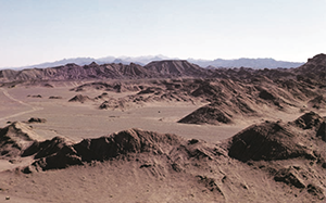
Helmand River and Helmand Valley
The Helmand River is the longest river in Afghanistan, beginning in the snows of the Koh-i Baba Mountains to the east and flowing 1300 km to the southwest to empty in the hamuns at the…
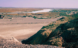
The Hamun Lakes
These lakes receive the total discharge of the lower Helmand River in this endorheic (closed) basin. The several hamuns, covering as much as 4000 sq km, are very shallow (1-2 m deep). They are bordered…
Rud-i Biyaban
This distributary watercourse runs almost 100 km west from Chahar Burjak on the Helmand River to the south end of Hamun-i Helmand in Iran. It is presumed to be the course of the Helmand during…
Shela Rud and Gaud-i Zirreh
The Shela Rud is a normally dry waterway flowing 70 km from the Hamun-i Helmand along the west edge of the Sistan Basin to the terminal basin of the Gaud-i Zirreh in the south. It…
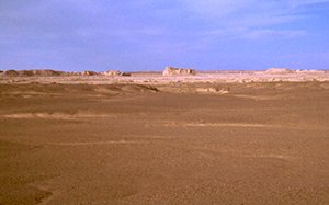
Sar-o-Tar
This flat plain, now abandoned and filled with sand dunes, is 40 x 80 km in size and sits to the east of the lower Helmand River, separated by a low bluff along the east…
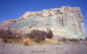
Mountains
Sistan is largely devoid of mountains, although it is bounded by them on the west in Iran and the south in Baluchistan. The volcanic mountains, created by the clash of the Afghan block with the…
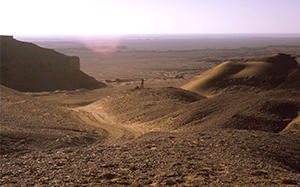
Deserts
Inside the curve of the Helmand River are two deserts: Dasht-i Margo, which overlies the alluvial fill and Tertiary lakebeds of the Helmand Basin; and Dasht-i Jehannum, located between the Sar-o-Tar Plain and the Helmand…
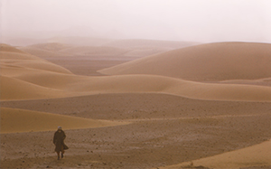
Wind of 120 Days
Undoubtedly the most documented climatic feature of this region is the Wind of 120 Days, commented upon by medieval Arab writers, by early European travelers, and experienced by all who live and work in Sistan.…
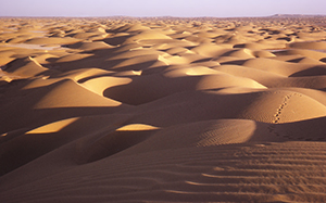
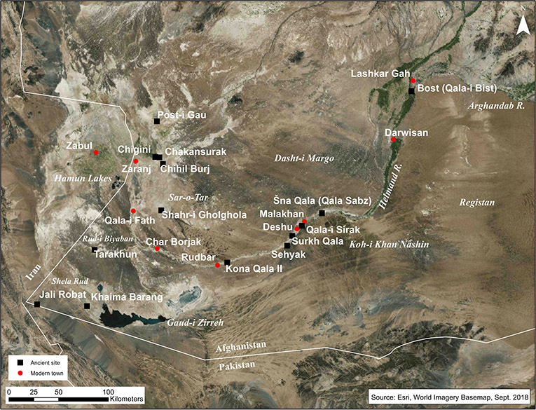
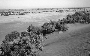
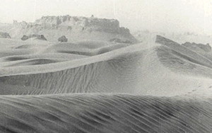
Sand Dunes
Dunes are a feature of the Sistan landscape and have been for a long time. Our excavations discovered that walls at Qala 169, dating to around 1000 BCE, were founded on a bed of sand.…