

Qala-i Sirak
Gazetteer ID: 881
Latitude: 30.45853036 Longitude: 63.36239907
Enlarged satellite view
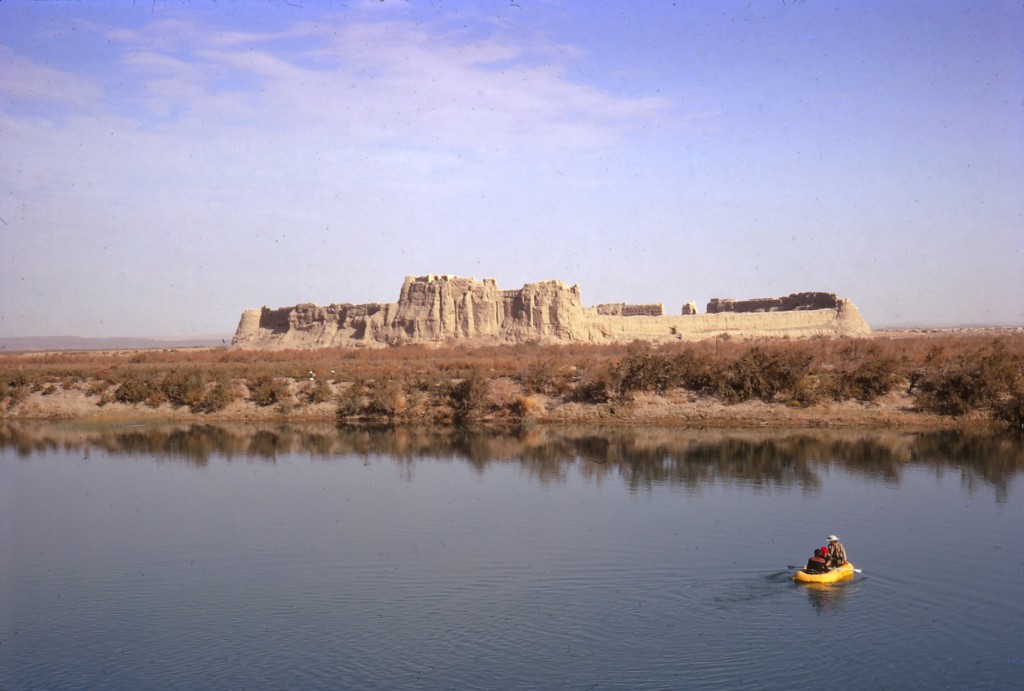
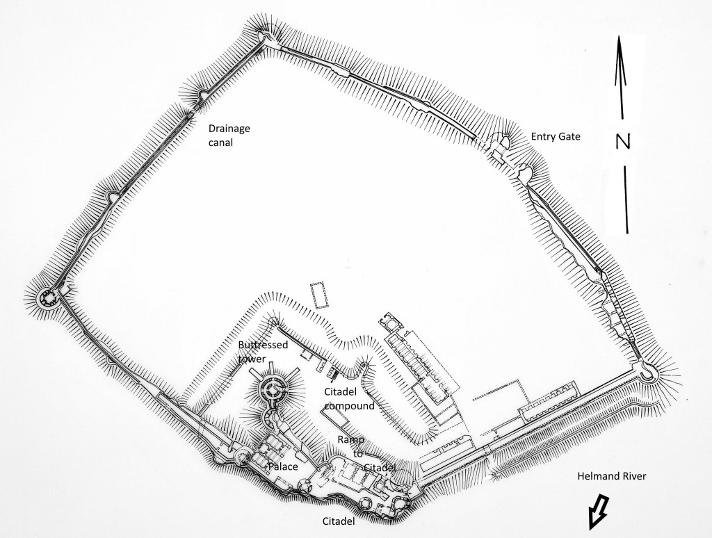
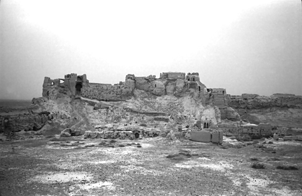
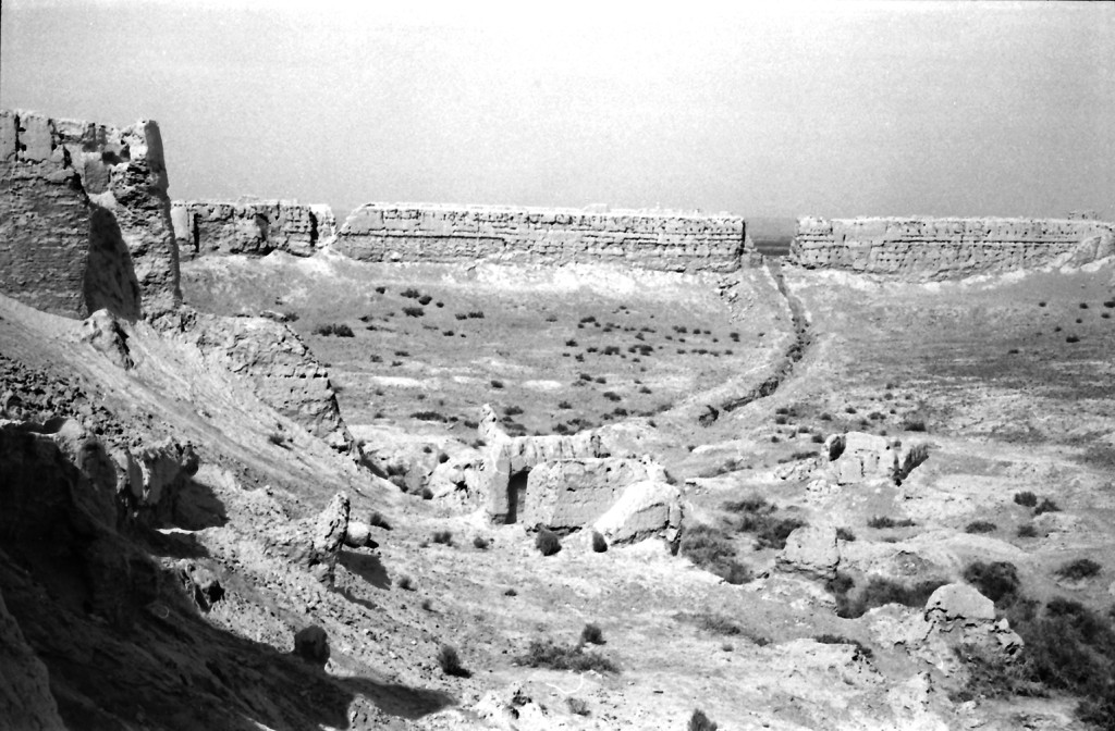
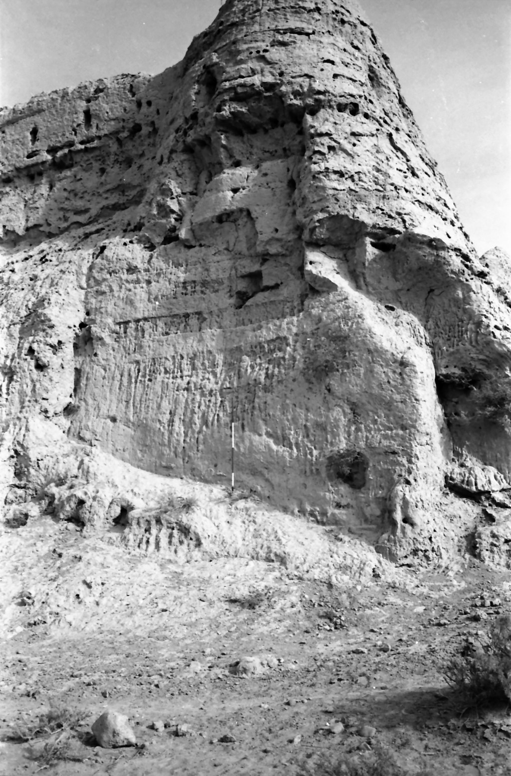
This is one of the largest archaeological sites in the Helmand Valley, a massive fortress sitting on the right bank of the Helmand River near the modern town of Malakhan. Based upon pottery found in our survey of the site, Qala-i Sirak has been occupied almost continuously from the Bronze Age to the present. The local village khan volunteered that his grandfather had lived there as recently as the early 20th century. Because of its recent occupation, the site is well preserved with enormous mudbrick defensive walls stretching as long as 220 m on a side still intact and dotted with regularly spaced towers. The entrance through these walls is on the northeastern side at the top of a steep, defensible ramp. A canal was cut through the northwest wall to bring water trapped inside the compound to the nearby village. This trench provided us with a cross section of the construction of the massive wall. The site is anchored by a 30 m high citadel on the southern corner, with a defensive wall and moat surrounding it and a monumental entry ramp rising from the interior courtyard of the site. A large, recent multi-story “palace” sits atop the citadel, connected by a narrow passageway with a large circular tower supported by four large mudbrick buttresses. Smaller buildings grace other sections of the courtyard inside the walls. Earlier building phases of the current walls are visible at various points. The predominance of pre-Islamic pottery on the ground demonstrates that the citadel was built upon earlier ruins, possibly a platform from the Bronze Age or Early Iron Age.