

House 139
Latitude: 30.56286 Longitude: 62.10363
Enlarged satellite view
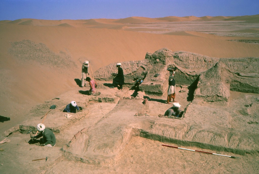
This large agricultural estate is located on the Sar-o-Tar Plain just south of Shahr-i Gholghola. We mapped the site in 1973 and partially excavated the badly eroded building in 1974. House 139 consisted of a series of rooms around a central courtyard with an entrance at the eastern side. The north side of the building was buried under sand dunes by 1974, so the excavation focused on six rooms on the south. These proved to contain features such as pits, pools, and other industrial installations. The eroding base of walls and doorways were repaired in ancient times and replaced using standing baked bricks and large fragments of storage jars. A carbon-14 sample from an early floor in the courtyard returned a 1st century BCE date. The site is filled with typical Parthian ceramics, confirming its date to the Parthian period, though it was reused sporadically in later times.