


Shahr-i Gholghola
Gazetteer ID: 1006
Latitude: 30.57893266 Longitude: 62.09031513
Enlarged satellite view
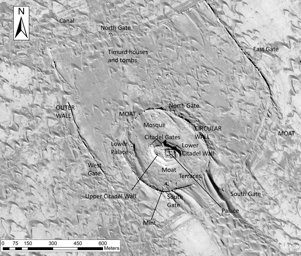
Probably the Islamic fortress city of Taq mentioned in numerous medieval texts, Shahr-i Gholghola is the largest single site in our project area, with standing walls over 1 km in length and over 10 m high on each side. Five different wall systems and three moats protect the main palace on the citadel at the center of the site, built by the Saffarid kings in the 9th or early 10th century. The three-story Citadel Palace is very unusual in its design and may be the only known monumental Saffarid building. The citadel also contains a bathhouse, built in Ghaznavid times and reused in Timurid times. A narrow trench was excavated on the west side of the citadel and disclosed that the Saffarid palace was built upon earlier Sasanian and Parthian public buildings. The Saffarid city also included a mosque, bazaar, and caravanserai north of the citadel and a district of elaborate homes to the east. All were reused in Ghaznavid and Ghorid times and display evidence of being destroyed by the armies of Genghiz Khan in 1222. With the Ghaznavid conquest of this area in the 11th century, the Citadel Palace was replaced by a much more elaborate Lower Palace with a unique 8-iwan courtyard and decorative and architectural elements reminiscent of Ghaznavid palaces in Ghazni and Lashkari Bazar. Remains of the succeeding Timurid period were modest, consisting largely of manor houses and canals built in the outer reaches of the defensive walls. Large quantities of cultural objects from both pre-Islamic and Islamic periods were found: coin hoards, fine ceramics, groundstone tools, bronze and silver jewelry, glass vessels, and metal objects.
Shahr-i Gholghola: Wall Systems
Shahr-i Gholghola: Citadel Palace
Shahr-i Gholghola: Lower Palace
Shahr-i Gholghola: Mosque and Bazaar