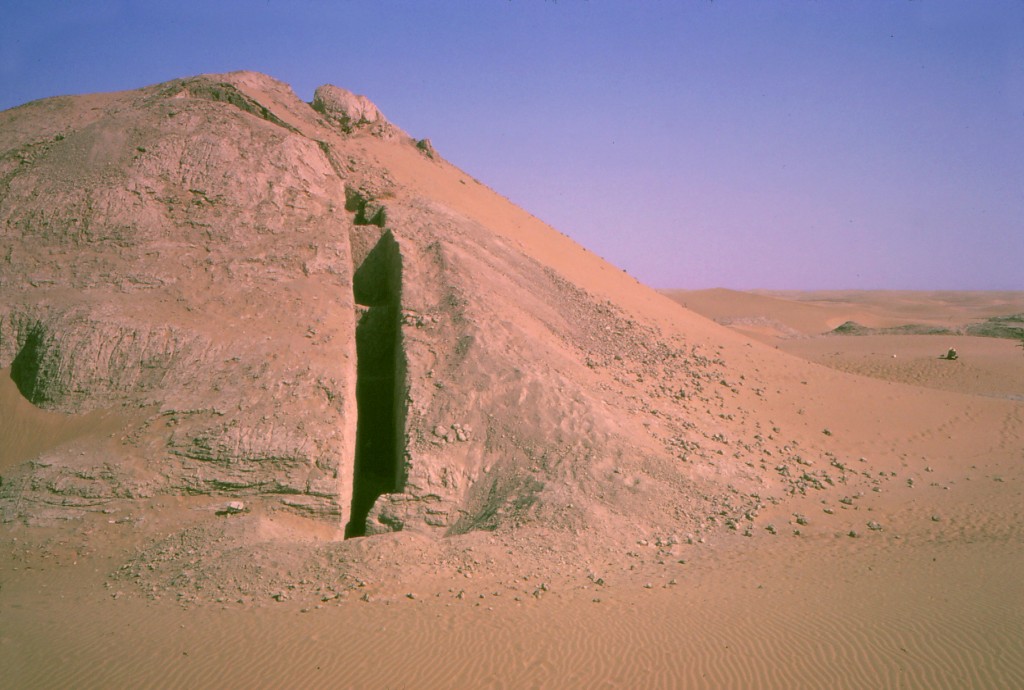


Qala 169
Latitude: 30.55486868 Longitude: 62.09461026
Enlarged satellite view
A large Sar-o-Tar fortified mound 50 x 80 m in size and 15 m high is surrounded by a lower circular walled compound to the southeast 140 x 80 m in dimension. It is where we first identified in 1971 a type of painted pottery we later determined to be from the Early Iron Age. We returned to excavate six trenches across the site in 1974, uncovering its core pakhsa platform and several succeeding rebuildings in mudbrick. The three earliest occupation levels date to the Early Iron Age and are located on top of the mound, at its base, and within the compound. A final mudbrick cap on the top of the mound dates from Partho-Sasanian times. We found an additional 20 sites from the Early Iron Age in our survey, a culture not previously known to archaeologists, the largest of which was Qala 350A.